


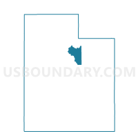
Wasatch County - Southfields Voting District, Wasatch County, Utah
About
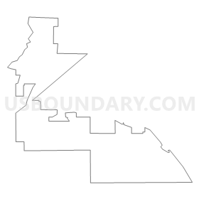
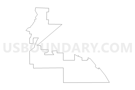
Outline
Summary
| Unique Area Identifier | 680375 |
| Name | Wasatch County - Southfields Voting District |
| County | Wasatch County |
| State | Utah |
| Area (square miles) | 9.21 |
| Land Area (square miles) | 9.21 |
| Water Area (square miles) | 0.00 |
| % of Land Area | 100.00 |
| % of Water Area | 0.00 |
| Latitude of the Internal Point | 40.46136010 |
| Longtitude of the Internal Point | -111.41826070 |
Maps

Graphs
Select a template below for downloading or customizing gragh for Wasatch County - Southfields Voting District, Wasatch County, Utah


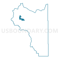
Neighbors
Neighoring Voting District (by Name) Neighboring Voting District on the Map
- Charleston Town Voting District, Wasatch County, UT
- Charleston Town - Annex Voting District, Wasatch County, UT
- Daniel Town - West Voting District, Wasatch County, UT
- Heber City - Fairgrounds Voting District, Wasatch County, UT
- Heber City - South Voting District, Wasatch County, UT
- Heber City - Special Event Center Voting District, Wasatch County, UT
- Wasatch County - Center Creek Voting District, Wasatch County, UT
- Wasatch County - North Voting District, Wasatch County, UT
- Wasatch County - South Voting District, Wasatch County, UT
- Wasatch County - West Voting District, Wasatch County, UT
Top 10 Neighboring County Subdivision (by Population) Neighboring County Subdivision on the Map
- Heber City East CCD, Wasatch County, UT (9,965)
- Heber City West CCD, Wasatch County, UT (8,133)
- Heber City South CCD, Wasatch County, UT (3,335)
Top 10 Neighboring Place (by Population) Neighboring Place on the Map
Top 10 Neighboring Unified School District (by Population) Neighboring Unified School District on the Map
Top 10 Neighboring State Legislative District Lower Chamber (by Population) Neighboring State Legislative District Lower Chamber on the Map
Top 10 Neighboring State Legislative District Upper Chamber (by Population) Neighboring State Legislative District Upper Chamber on the Map
Top 10 Neighboring 111th Congressional District (by Population) Neighboring 111th Congressional District on the Map
Top 10 Neighboring Census Tract (by Population) Neighboring Census Tract on the Map
- Census Tract 9405, Wasatch County, UT (8,614)
- Census Tract 9604, Wasatch County, UT (5,092)
- Census Tract 9601, Wasatch County, UT (3,904)